The Essential Guide to Visiting the Mono Lake Tufa Towers
At first glance, Mono Lake doesn’t look like much. Driving past it and not knowing anything about it, you’d be forgiven for chalking it up to just another old, barren lake on its way out of existence. At least that’s what we thought the first couple of times we drove past it on our way to Yosemite.
Once we looked it up and started doing research, though, we were quickly intrigued by its history and unique features. The biggest and most known of those features being the tufa formations along the shores of the lake, the largest concentration of which can be found at the Mono Lake Tufa State Natural Reserve.
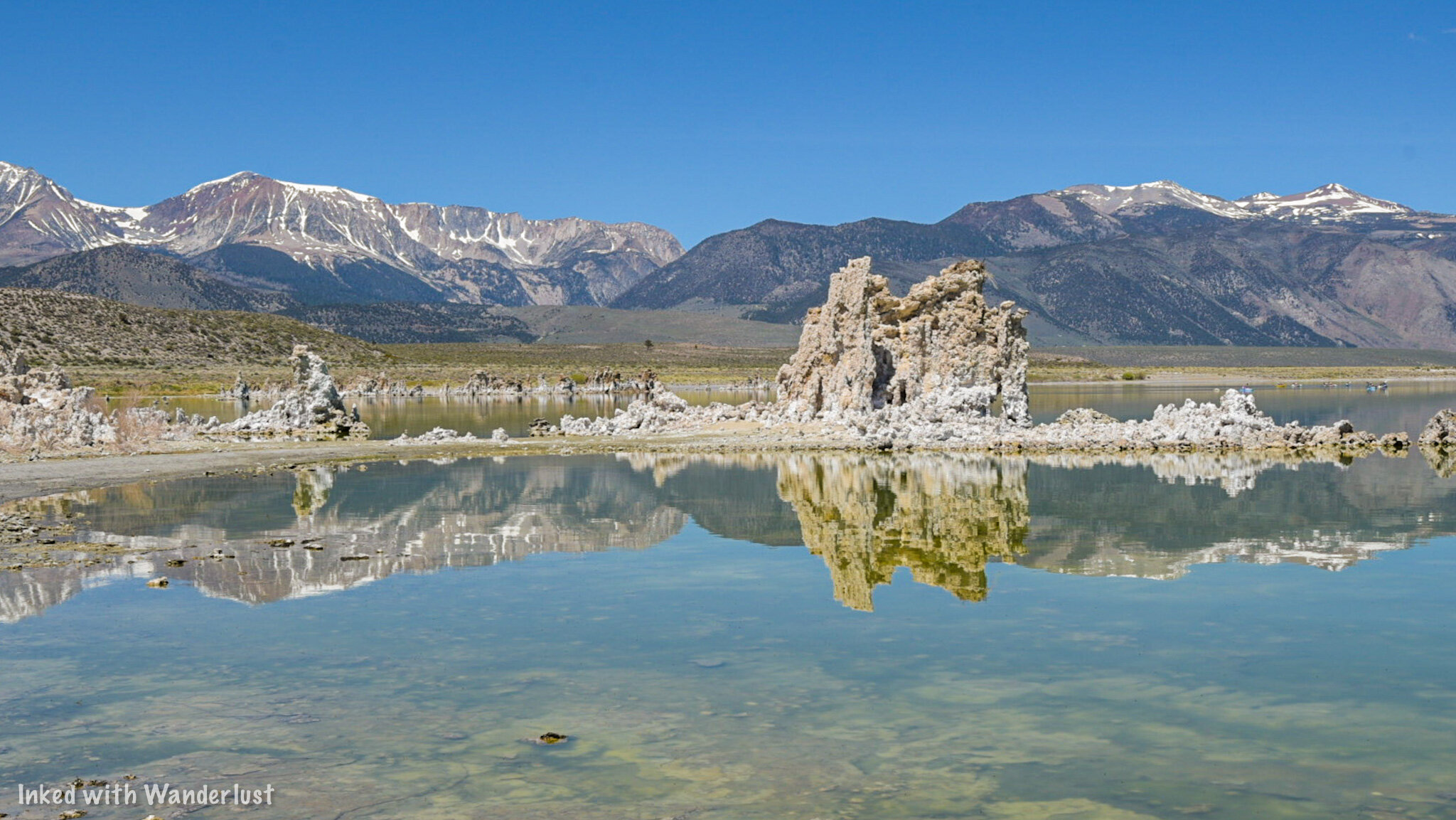
From the parking lot, it doesn’t look like much, but once you start making your way on the boardwalk down to the shore, you’ll quickly realize how truly amazing and beautiful this lake is. As my wife pointed out, walking among the tufa formations gives you the feeling of being in the underwater domain of King Triton.
There are a few access points to the shoreline of Mono Lake, but this article is going to focus on the State Reserve portion of the shoreline as it’s the area with the largest concentration of tufas and all monies collected goes towards the preservation of this wonderful place. It’ll also give you all the information you’ll need to help plan your visit. Let’s get to it.
The Visitor Center
Mono Lake Visitor Center in Lee Vining, California.
I firmly believe that all visits to places to such Mono Lake should either begin or end at the visitor center. A lot of people skip them, but they are essential to the preservation and education of natural resources. The Mono Basin Visitor Center is no different. They’ve recently re-opened for the first time since 2019 and we (finally) had the pleasure of visiting.
This visitor center contains many exhibits explaining the history and development of not just Mono Lake, but Mono Basin as a whole. The main exhibit, which is located adjacent to the information desk, walks you through the development of Mono Lake’s tufa formations and the variants, before moving on to the wildlife that call the lake home and finishing with Native American history of the region.
Exhibit Hall in Mono Basin Visitor Center.
An example of an Ice Age Tufa in the Mono Basin Visitor Center.
Other features include a room filled with wonderful images by a variety of Photographers, a detailed display explaining the history of the region and how Yosemite once had a much closer relationship to the lake than it does now, an information desk, a viewing deck in the back, a nature trail, and a gift shop.
An example of a brine shrimp.
Behind the visitor center is where you’ll find the viewing deck. You’ll get a sweeping view of the lake and be able to take the “Secrets of Survival” nature trail that offers a direct route to the shore of the lake. The trail is maybe a mile, roundtrip and from what we could see, it looked like a gentle decent.
View of Mono Lake from the viewing deck.
The hours of operation for the visitor center varies depending on the season:
Summer: Open daily from 8am to 5pm
Spring & Fall: Open from 8:30am to 4:40pm Thursday - Monday (closed Tuesdays & Wednesdays)
Winter: Closed for the season
The address is as follows:
Lee Vining Creek Trail, Lee Vining, CA 93541
It’s really easy to find as it’s just off Highway 395. If you’re coming from Lee Vining, you’ll travel north on 395 and turn right at the sign (just after passing the school). If you’re coming from Bridgeport or Hawthorne, you’ll see the Mono Basin sign on the left side of the road. Turn here. Continue on the road until you see the visitor center on your right.
The State Reserve
Mono Lake Tufa State Natural Reserve
The reserve was established in order to protect the tufa formations found along the shore. This small section of the lake contains the largest concentration of the tufas and features a 1-mile interpretive loop trail with signage detailing the formation of the tufas, the local wildlife, and more.
Directions
Both Apple and Google maps seem to be confused on how to get here and give wildly different directions depending which you use. For example, I typed in, “Mono Lake Tufa State Natural Reserve”, which is what this park is called, and Google directions wanted to take me in the opposite direction to the visitor center. For simplicity, here are the two routes you can take to get there:
From Lee Vining, travel south on highway 395 for a few miles and turn left (or right from the opposite direction) on Picnic Grounds road.
Just before reaching the campground, you’ll turn right on Test Station road (turns to gravel).
Continue straight on this road until you reach the parking lot on the left. You’ll know you’re heading in the right direction when you see the old house pictured below.
Old house near Mono Lake along Test Station road.
The other way you can get here is as follows:
From Lee Vining, travel south on highway 395 (passing Picnic Grounds road) and turn left (or right traveling north) on Mono Lakes Basin road.
Take this paved road for around 5-miles, then turn left on Test Station road (turns to gravel).
You’ll travel this road for a short time before turning left into the parking lot.
Neither way will take you very long and both will provide easy access to the reserve. The only real differences are the views coming into the park and access during winter. Mono Lakes Basin road is well plowed during the winter (unless it was a particularly heavy storm) and in my opinion, it would be the better option during that time.
READ ALSO: The Essential Guide To Visiting Burney Falls
Fees and Parking
Mono Lake boardwalk.
As with most state and federal designated parks, there is a fee to come here and they are as follows:
$3.00 per person 16 and up
Kids 15 and younger are free
If you have the Interagency Pass, it is honored here
These days, the park seems to follow the honor system as there hasn’t been a heavy Ranger presence like in the past. There is a pay station with envelopes where you’ll fill out your vehicle information and insert your payment. You’ll rip off the tab to place on your dashboard and insert the envelope into the lockbox.
Keep in mind that there are no electronic pay stations where you can use your credit card. This is a cash only park and you’ll want to bring exact change (unless you’re willing to donate the difference). Park Rangers and Mono County Deputies do make regular rounds checking vehicles for pay stubs and will issue fines to those who haven’t paid.
The parking lot is fairly large and could hold a decent amount of vehicles. There’s space for RV’s to park as well. Bathrooms are located at the north end with the entrance at the center just beyond the perimeter of the lot. For those who just want a view, benches are placed to the left of the entrance and face the lake.
The Tufas and Loop Trail
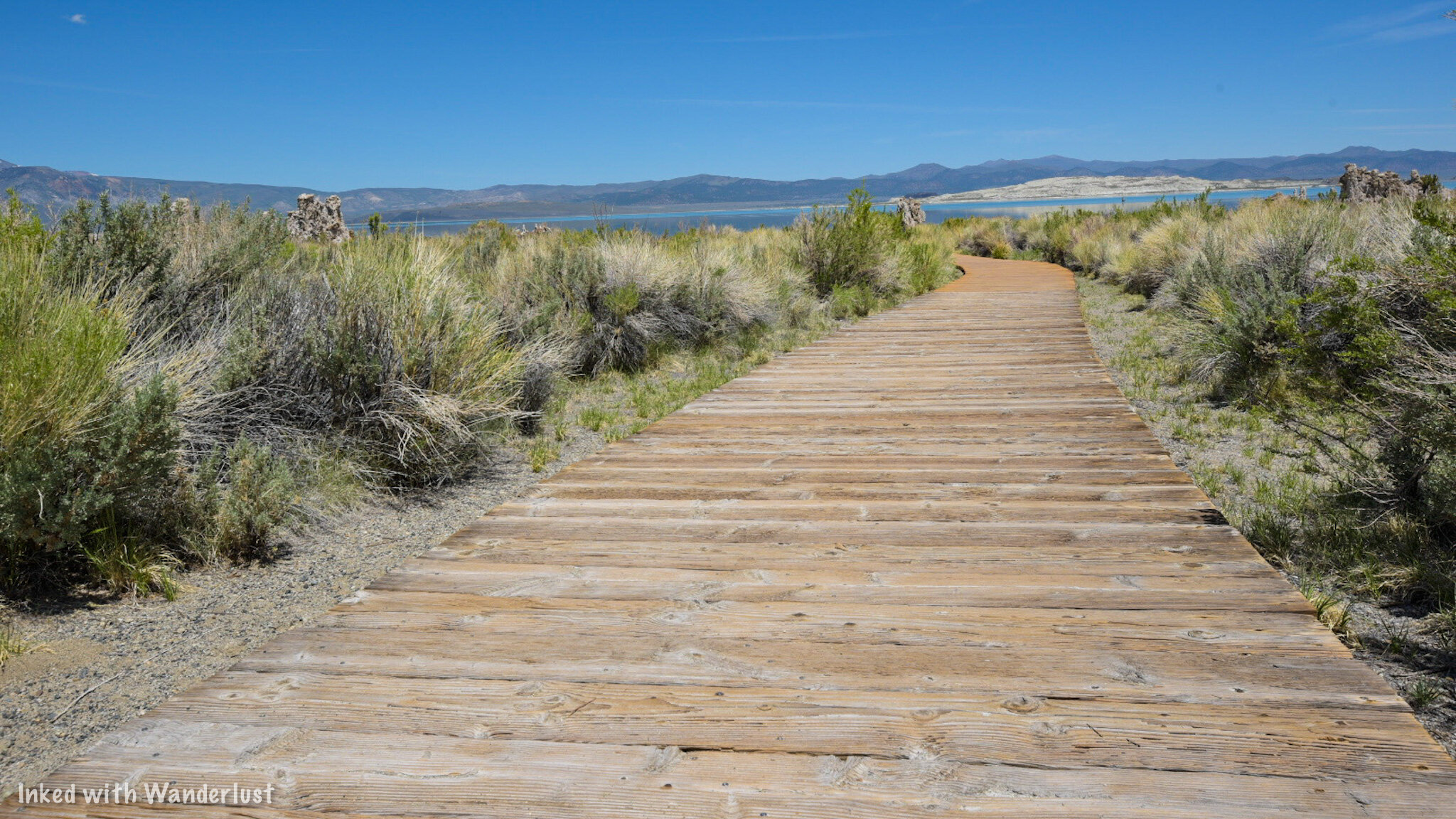
The boardwalk at Mono Lake Tufa State Reserve.
The one-mile loop tail starts at the entrance and begins as dirt before moving you onto a wooden boardwalk. You’ll see the first major example of tufas on your left just before getting onto the boardwalk. On the right side of the trail, you’ll see markers indicating past water levels of that particular spot. Yes, you’re walking along what was once the bottom of the lake.
Your first glimpse of the Mono Lake tufas.
At the end of the boardwalk, you’ll step out onto the sandy shores of the park and start seeing the large tufa formations up close. From here, the trail continues to the right but you’re free to break off and explore the tufas at your leisure. Just be sure to not climb or stand on them as they are very fragile.
Along the water’s edge you’ll no doubt take note of the massive amount of tiny flies. These are Alkali Flies and are harmless. They spend 3 of their 4 stages of life beneath the surface of the lake (contributing to the formation of tufas in the process) and spend their adult stage at the surface feeding off algea.
A tufa with a window at Mono Lake.
Interpretive signs dot the trail and further explain the history of the area. From this point, the official trail can be a little difficult to follow as you’ll be presented with many opportunities to explore the tufas up close. Just keep an eye out for those little brown trail markers indicating the path.
Tufas at Mono Lake.
Tufas beneath the surface of Mono Lake.
Tufas that are above the surface of water have stopped developing and are now at the mercy of the elements (and us). The one’s beneath the surface can still be in active development. In fact, if you look closely enough, you’ll see bubbling in the water in some spots. This is indicative of underwater hot springs rich in calcium interacting with the lake water to form the tufas.
So if you do see bubbling, that’s nature at work still developing these amazing limestone formations. We managed to spot a few examples of this at the south end of the park at the water’s edge. I’ve also read that kayakers and swimmers have come across large bubbling events further out into the lake.
Other Activities
Kayakers on Mono Lake.
Kayaking
While motorized water crafts are prohibited, human-powered vessels such as kayaks are permitted. If you have your own kayak, you can launch from nearby Navy Beach at the south end of the lake. If not, several outfitters provide kayak rentals and organized tours. One such outfit is Caldera Kayak.
Swimming
Swimming is also permitted in the lake (just not from the state reserve). You’ll just need to be sure to avoid hitting the tufas. Before diving in, be certain you have no cuts or sores on your body and keep the water out of your eyes. Mono Lake has 2.5 times the salt concentration as the ocean. It WILL hurt.
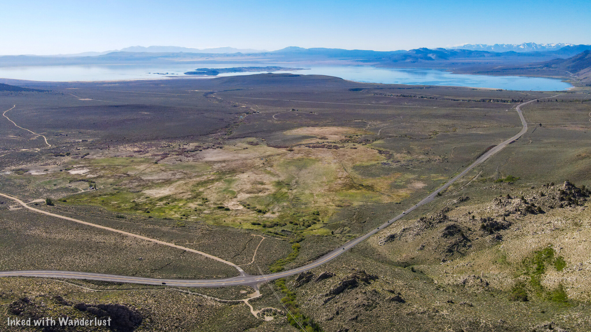
Mono Lake from above.
Birding/Photography
Another popular activity here is bird watching/photography. The lake contains no fish at all but is home to the aforementioned Alkali Flies and Brine Shrimp. Due to this, Mono Lake attracts around 300 species of birds that feed on the flies/shrimp and use the tufas to nest. So if that’s what you’re into, you can’t go wrong here.
Photography is another favorite. Photographers from all over the world have come to Mono Lake to capture its beauty, particularly at sunrise and sunset. Drone use at the state reserve and directly above the surface of the lake is prohibited. However, there are other parts of the lake where you could launch from provided you don’t fly over the surface.
Viewpoints
Mono Lake from the Highway 395 viewpoint.
There are a few other viewpoints but the one I feel is worth pointing out is the pullout from highway 395 coming into Lee Vining from Bridgeport. You get a “from above” view (even more so with a drone) and there’s more interpretive signs as well. They don’t say anything different than what the ones at the lake and at the visitor center say, though.
Coming from Bridgeport, you’ll find the pullout on your right shortly after passing Virginia Lakes road (just before you start descending). To get here from Lee Vining, travel north of highway 395. As you near the top of your ascent, you’ll see the pullout on your left.
Nearby Attractions
There are many additional attractions located near Mono Lake. We wrote two articles entitled, “7 Things You Will Love About Lee Vining” and “7 Things You Will Love About Bridgeport” that give examples of things you can do or see in those respective towns. Mono Lake is located in Lee Vining while Bridgeport is just a short drive north on 395.
Below, we’ll list a few of the major attractions you MUST see while you’re in the area and the links to our articles on them:
Conclusion
We hope you enjoyed this article about Mono Lake and that it was helpful to you in planning or inspiring your travel plans. If so, please consider support this site by sharing it with your friends and family on social media. Thank you and safe travels!


